
THANK YOU FOR SUBSCRIBING
× 
Construction Tech Review Weekly Brief
Be first to read the latest tech news, Industry Leader's Insights, and CIO interviews of medium and large enterprises exclusively from Construction Tech Review


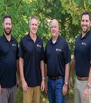 Ken Herwig, Partner, Steve Thomas, Partner, Steve Narducci, Partner and Alex Miller, Partner
MESH Consulting operates in that space, bridging engineering and construction with modeling, quality control, survey, layout, BIM and site-balancing services designed to eliminate uncertainty before it reaches the jobsite.
“We’re that liaison in the middle that is fluent in engineering and construction,” says Alex Miller, partner, GPS Modeling.
It is a simple description of a role that is becoming increasingly important as construction projects grow more data-intensive. Engineers may be responsible for producing an approved design, while contractors are responsible for making that design buildable. Between the two sits a layer of interpretation, coordination and verification that can determine whether a project progresses smoothly or encounters problems in the field.
From Digital Design to Constructible Reality
MESH was founded by Stephen Thomas and Stephen Narducci after years of working in surveying, civil engineering, construction and management. Their experience exposed a recurring problem: engineering teams and construction teams often had the information they needed, but not necessarily a shared way of working with it.
The emergence of 3D machine control presented an opportunity. Contractors could use GPS-guided equipment to work faster and with greater precision, but only if the underlying digital model was accurate, constructible and compatible with the equipment being used.
Rather than simply taking a CAD file, generating a surface and sending it to the field, MESH approaches the model as a quality control exercise. Its team examines plans, details, contours and design intent, looking for discrepancies that might otherwise remain hidden until construction begins. The distinction matters because an engineering file and a construction model are not necessarily the same thing.
A design can satisfy the requirements of an approval process without capturing every high point, low point or constructability issue that a contractor must confront. MESH’s survey quality modeling approach is intended to bridge that difference, producing data that can be used by machines and survey teams while providing a clearer representation of how the project is expected to be built.
The company describes its models as survey quality, with contour intervals modeled to two-tenths of a foot to expose details that can be obscured in more generalized representations. That level of scrutiny also allows the team to flag issues and, when necessary, prepare RFI documentation so clients can take specific questions back to the engineer or owner.
The Cost of a File That Does Not Match
One of the most revealing challenges Miller describes is surprisingly basic: plans and CAD files often do not match.
Construction information can pass through multiple revisions and people before it reaches a crew in the field. A contractor may be working from one set of drawings while receiving CAD data from another revision. Without someone actively comparing the two, the discrepancy can go unnoticed until construction exposes it.
For a contractor, discovering that problem at the jobsite can have an outsized cost. Crews may have to stop, equipment may sit idle and questions may need to travel back through several layers of a project organization before anyone can provide an answer.
MESH’s role is partly technical and partly organizational. Its teams keep the digital information open, compare sources and identify what does and does not align. In effect, the company becomes an additional layer of project control for clients that may not have the personnel or software to manage that process internally.
A Burlington Apartments multifamily development in New Jersey illustrates MESH’s approach. Brought in by sitework contractor Allan Myers to build the machine-control model, MESH identified grading issues in areas already under construction and quickly redesigned the grading and stormwater drainage, allowing crews to keep moving. In later phases, its value engineering drastically reduced imported material, while survey layout for curb, sanitary, water and storm utilities carried the solution into the field. The result: improved accuracy, reduced rework, schedule continuity and substantial cost savings.
Precision That Extends Beyond the Machine
MESH’s capabilities now extend beyond GPS modeling. Its teams work across survey, IGP, BIM and specialized infrastructure modeling, allowing the company to support projects ranging from warehouses and data centers to highways and airports.
For routine building projects, the modeling process may be relatively familiar. The complexity increases when the work involves major infrastructure or dense utility coordination. Highway and airport projects can require teams to verify alignments, stationing, offsets, pavement details, lighting, signage, markings and cross-sections with a level of scrutiny that goes far beyond a conventional site-development model.
The company’s growing BIM capability adds another dimension, particularly around subsurface utilities. As construction workflows increasingly rely on coordinated digital models, MESH sees an opportunity to identify utility conflicts before they become field problems and to connect that digital coordination with survey and construction layout.
-
For contractors, the promise of digital construction is not a better-looking model on a screen, but information that corresponds to what will actually happen in the field.
The company’s growing BIM capability adds another dimension, particularly around subsurface utilities. As construction workflows increasingly rely on coordinated digital models, MESH sees an opportunity to identify utility conflicts before they become field problems and to connect that digital coordination with survey and construction layout.
The larger trend is significant. Construction is becoming more digital, but digital does not automatically mean coordinated. More data can create more opportunities for mismatches unless someone is responsible for making the information usable.
Making Dirt Work Smarter
Traditional site-balancing calculations can be based on a development plan before the exact housing products are known. Yet the excavation required for a large home can differ significantly from that of a smaller one, creating different volumes of spoil on individual lots. If those differences are not incorporated into the balancing strategy, soil may have to be hauled away only to create a need for imported material elsewhere.
MESH’s two-step grading process addresses that problem by coordinating the development plans with the builder’s actual house selections. The company can identify which home will sit on each lot, calculate the associated excavation and incorporate those quantities into a lot-by-lot balancing process.
The value is easy to understand because the underlying economics are so tangible.
“If I’ve learned anything from this job, it’s that moving dirt can be very expensive,” Miller says.
By accounting for the actual housing product earlier, contractors can potentially reduce unnecessary export and make better use of material already on the site.
Engineering the Next Layer of Construction Technology
Today, MESH has grown into a 35-plus-person organization serving hundreds of clients across the East Coast while expanding into the Midwest. The company’s development suggests that its opportunity is no longer limited to machine-control modeling. As contractors adopt more technology, they need partners capable of translating between platforms, disciplines and project stages.
MESH’s experience with both Trimble and Topcon systems reflects that reality. Its modeling environment may lean toward Trimble, but its team maintains the equipment, software knowledge and workflow familiarity required to support both platforms.
Over the next three to five years, MESH plans to remain at the forefront of GPS machine control through its survey-quality 3D modeling while expanding its work in value engineering, interim grading design and civil BIM. The company aims to continue linking sitework design and construction, from concept grading, constructability review and earthwork balancing through as-built documentation.
For contractors, the promise of digital construction is not a better-looking model on a screen. It knows that the information on that screen corresponds to what will actually happen in the dirt, on the slab and beneath the surface. That is ultimately what MESH is selling: not just a model or another layer of project support, but greater certainty before construction begins.
What Makes GPS Machine Control Data Field-Ready
Machine control can shorten grading cycles, but the purchase itself does not solve the harder problem. Contractors still need design data translated into a model that can be trusted in the field. A six-figure hardware investment can stall when CAD files do not match current plan sets, when revisions are unclear, when surfaces omit construction detail or when a model cannot be loaded cleanly into the equipment on site. The buying decision therefore extends beyond software features or receiver accuracy. It depends on whether the provider can turn design information into usable field data before crews are exposed to discrepancies.
Revision control deserves close scrutiny. Construction teams often work from tablets or phones while CAD files remain with engineers, estimators, surveyors or outside consultants. Plans may move through several revisions while the digital files used for modeling follow a different timeline. A provider should be able to compare source files against revision dates and stop questionable information from moving downstream. The practical value is not administrative neatness. It is avoiding grading or stakeout work based on superseded information, when correction means rework and additional machine time.
“When discrepancies appear, MESH Consulting can document them through RFI letters and communicate the concern in terms engineers and construction teams can act on.”
Model quality is equally important because design approval does not automatically produce a construction-ready surface. Grading plans may communicate design intent while leaving curb geometry or basin details incomplete in the underlying CAD data. Buyers should examine how thoroughly a provider checks grades against plan details and whether it can identify conflicts before release. The useful distinction is between a model that supports bidding and one that can guide construction. Field-ready data should reflect enough vertical and horizontal detail for machine control and survey layout rather than merely reproduce contours from the design file.
Equipment compatibility introduces another failure point. A CAD file that appears complete on a workstation may contain entities that do not transfer correctly into machine-control systems. File preparation should account for the equipment actually used by the contractor, including differences between Trimble and Topcon workflows. Buyers should also look beyond export format. A provider familiar with how each system behaves can reduce the risk of a model arriving on site in a form that operators cannot use as intended.
Response discipline matters once questions surface. Model review frequently uncovers discrepancies that require clarification from the engineer or owner. A useful provider should be able to document those concerns, keep the contractor informed, frame questions clearly and support the exchange until the issue is resolved. That communication role becomes especially important for contractors that do not maintain in-house CAD capability or dedicated modeling staff.
MESH Consulting builds survey-quality 3D machine-control models by checking plan details against CAD data before releasing files for field use. It works across Trimble and Topcon environments, using equipment and software from both systems to prepare compatible outputs. When discrepancies appear, MESH Consulting can document them through RFI letters and communicate the concern in terms engineers and construction teams can act on. Its engineering and field-construction background supports that translation without turning the service into design work. For contractors that need current and field-ready machine-control data before crews mobilize, MESH Consulting merits consideration as a modeling partner.
...Read more
| Share this Article: Tweet |

Company
MESH Consulting
Management
Ken Herwig, Partner, Steve Thomas, Partner, Steve Narducci, Partner and Alex Miller, Partner
Description
MESH Consulting is a construction technology and site engineering company specializing in GPS machine control modeling, construction surveying, value engineering, and BIM modeling. Established in 2007, the company develops survey-quality 3D models, provides drone and field surveying, supports grading and utility design, and helps contractors improve construction accuracy and efficiency.
Top
